


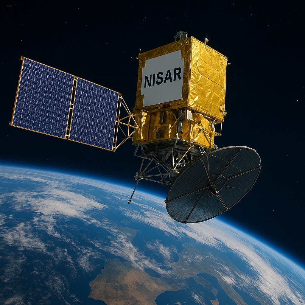
The NASA-ISRO Synthetic Aperture Radar (NISAR) satellite represents a groundbreaking achievement in international space collaboration and Earth observation technology. Successfully launched on July 30, 2025, from India's Satish Dhawan Space Centre, this revolutionary satellite marks the first radar imaging mission to use dual-frequency technology from a single platform.
What is NISAR?
NISAR is a joint mission between NASA and the Indian Space Research Organisation (ISRO), costing approximately $1.5 billion. This Low Earth Orbit (LEO) observatory weighs 2,393 kg and is designed to systematically map Earth's changing surface with unprecedented precision. The satellite orbits at an altitude of 747 km in a sun-synchronous polar orbit, enabling it to scan nearly all of Earth's land and ice surfaces every 12 days.
The mission represents a true 50-50 partnership between NASA and ISRO. NASA contributed the L-band radar system, GPS receiver, high-rate communication system, solid-state recorder, and the massive 12-meter deployable antenna. ISRO provided the S-band radar system, spacecraft bus, launch vehicle, and associated systems and services.
Revolutionary Dual-Frequency Radar Technology
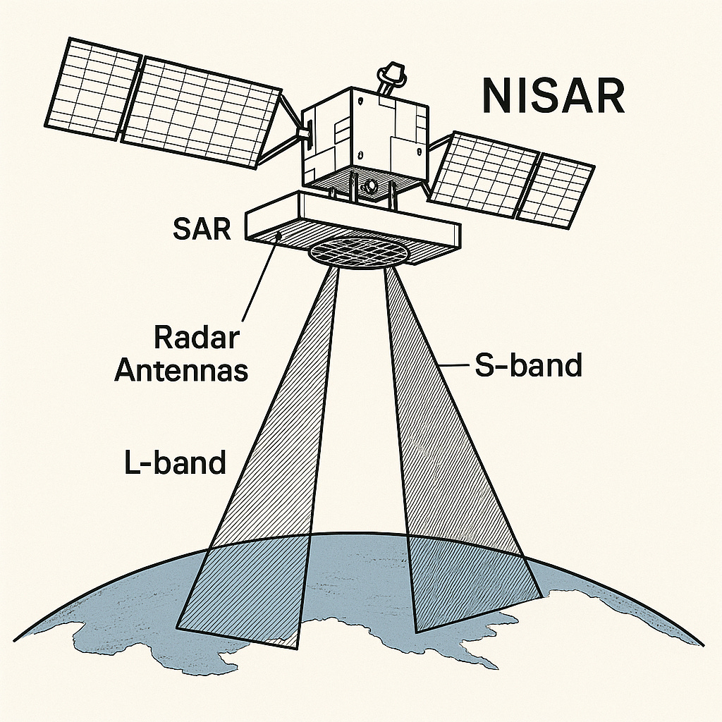
NISAR's most distinctive feature is its dual-band Synthetic Aperture Radar (SAR) system, making it the first satellite to employ both L-band and S-band radars simultaneously. This innovative approach provides complementary capabilities:
L-band Radar (24 cm wavelength)
Penetrates through vegetation, snow, and soil
Ideal for studying forest biomass, ice dynamics, and underground deformation
Operates at 1.25 GHz frequency with 3-48 meter spatial resolution
Can detect surface movements as small as 4 mm per year
S-band Radar (9-12 cm wavelength)
Focuses on surface-level features and moisture content
Excellent for crop monitoring, wetland mapping, and coastal studies
Operates at 3.2 GHz frequency with 3-24 meter spatial resolution
Less sensitive to ionospheric disturbances in polar regions
SweepSAR Technology: The Game Changer
NISAR employs the revolutionary SweepSAR technique, being its first space-based implementation. This innovative technology enables the satellite to achieve both wide area coverage and fine spatial resolution simultaneously:
Wide imaging swath of 242 km while maintaining high resolution
Uses a phased-array feed system that sweeps across the antenna reflector
Transmits signals to the entire swath, then receives echoes in quick succession
Processes multiple echoes simultaneously in real-time
Overcomes traditional radar limitations by varying pulse rates to eliminate coverage gaps.
How NISAR Differs from Existing Satellites
NISAR stands apart from existing Earth observation satellites in several crucial ways:
Unprecedented Coverage and Frequency: Unlike optical satellites limited by weather and daylight, NISAR operates 24/7 in all weather conditions, penetrating clouds, smoke, and vegetation. It provides global coverage every 12 days, far more frequent than most existing missions.
Dual-Frequency Advantage: Previous SAR missions typically used single-frequency systems. NISAR's dual-band approach provides complementary information - L-band for subsurface penetration and S-band for surface details.
Advanced Processing Power: The satellite generates approximately 80 terabytes of data daily, more than any previous remote-sensing satellite. Its sophisticated onboard processing capabilities enable near-real-time data availability.
Centimeter-Level Precision: NISAR can detect surface changes as small as one centimeter, providing unprecedented sensitivity for monitoring subtle Earth processes.
Advantages and Benefits to Mankind


Disaster Management and Risk Reduction: That includes early warning systems, rapid damage assessment, infrastructure monitoring.
Climate Change Monitoring and Environmental Protection: That includes ice sheet and glacier monitoring, forest and ecosystem management, permafrost and wetland monitoring.
Agricultural Monitoring and Food Security: That includes monitoring crop growth from planting to harvest, tracking plant health, soil moisture, and irrigation needs, track soil moisture and groundwater changes.
Technical Specifications and Architecture
NISAR's technical complexity represents a decade of engineering innovation:
Spacecraft Configuration: Built around ISRO's I-3K spacecraft bus, the satellite features a 12-meter deployable gold mesh antenna - the largest ever deployed for Earth observation. This antenna unfolds in space using a 9-meter boom system provided by NASA.
Orbital Parameters
Altitude: 747 km
Inclination: 98.4°
Repeat cycle: 12 days
Orbital period: 100 minutes
Time of nodal crossing (the point where a satellite's orbit intersects the Earth's equatorial plane): 6 AM/6 PM
Data Systems: The satellite features high-capacity solid-state recorders and dual Ka-band downlink systems supporting data rates up to 4.0 Gbps to NASA stations and 2.88 Gbps to ISRO stations. The mission conducts 15-20 downlink sessions daily with average session durations under 10 minutes.
Mission Duration: NASA requires a minimum three-year mission with L-band operations, while ISRO requires five years with S-band operations. The satellite carries sufficient fuel for potential mission extensions.
NISAR's launch marks the beginning of a new era in Earth observation. The mission's success will likely inspire additional multinational space collaborations, potentially involving European, Japanese, or African space agencies