

Different Navigational Technologies
A Global Perspective on Navigation Technologies


Hello friends, happy to inform you the project on Aircraft Deck playing cards got fully funded in just 5 hours of launch on Kickstarter. Thank you everyone for your support. If you are interested in getting one for you please check the project here.
Now, back to today’s article.
Introduction
China launched the last pair of backup satellites for its Beidou navigation system late 18th September 2024, with an eye on a future, upgraded system. So today our discussion will revovle around this.
Navigation has been a cornerstone of human exploration and commerce for centuries. From the celestial bodies guiding sailors across vast oceans to the intricate networks of roads and railways that crisscross continents, navigation has played a pivotal role in shaping our world. In the modern era, the advent of satellite navigation systems has revolutionized the way we travel, communicate, and conduct business.
This article delves into the various types of navigation technologies employed by different countries, the importance of backup satellites, the distinctions and commonalities between these technologies, their dual-use potential, the historical instances of misuse, the necessity for countries to have their own navigation technology, and the challenges and opportunities that lie ahead.
Types of Navigation Technologies
Though satellite based technologies like GPS is the first thing which comes to our mind when we talk about navigation, there are different types of techs. Let’s get to it one by one.
Global Navigation Satellite Systems (GNSS):
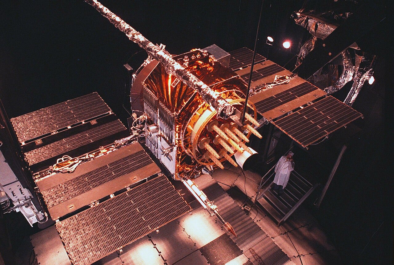
Global Positioning System Block II satellite pictured here in 1985 GPS (Global Positioning System): The GPS is perhaps the most widely known navigation system, originally developed by the U.S. Department of Defense in the 1970s. Initially designed for military use, it was made available for civilian use in the 1980s. Today, GPS is a global system that offers highly accurate location and time information, thanks to its constellation of 31 satellites.

First generation GLONASS Satellites GLONASS (Global Navigation Satellite System): The Global Navigation Satellite System (GLONASS) is Russia's answer to GPS. It was developed in the Soviet Union era and later modernized. Like GPS, it provides global coverage and is extensively used in both civilian and military applications.
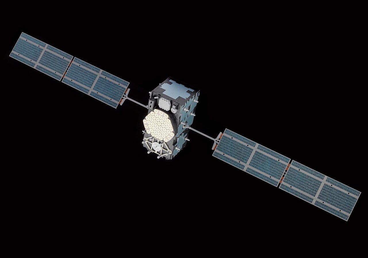
Model of a Galileo satellite. Credits: Science Museum Collections Galileo: Galileo is the European Union’s independent satellite navigation system, intended to provide a high-precision positioning system to reduce reliance on GPS or GLONASS. Operational since 2016, Galileo offers both civilian and encrypted government/military services. It is notable for its high accuracy, offering more precise positioning than GPS for civilian users.
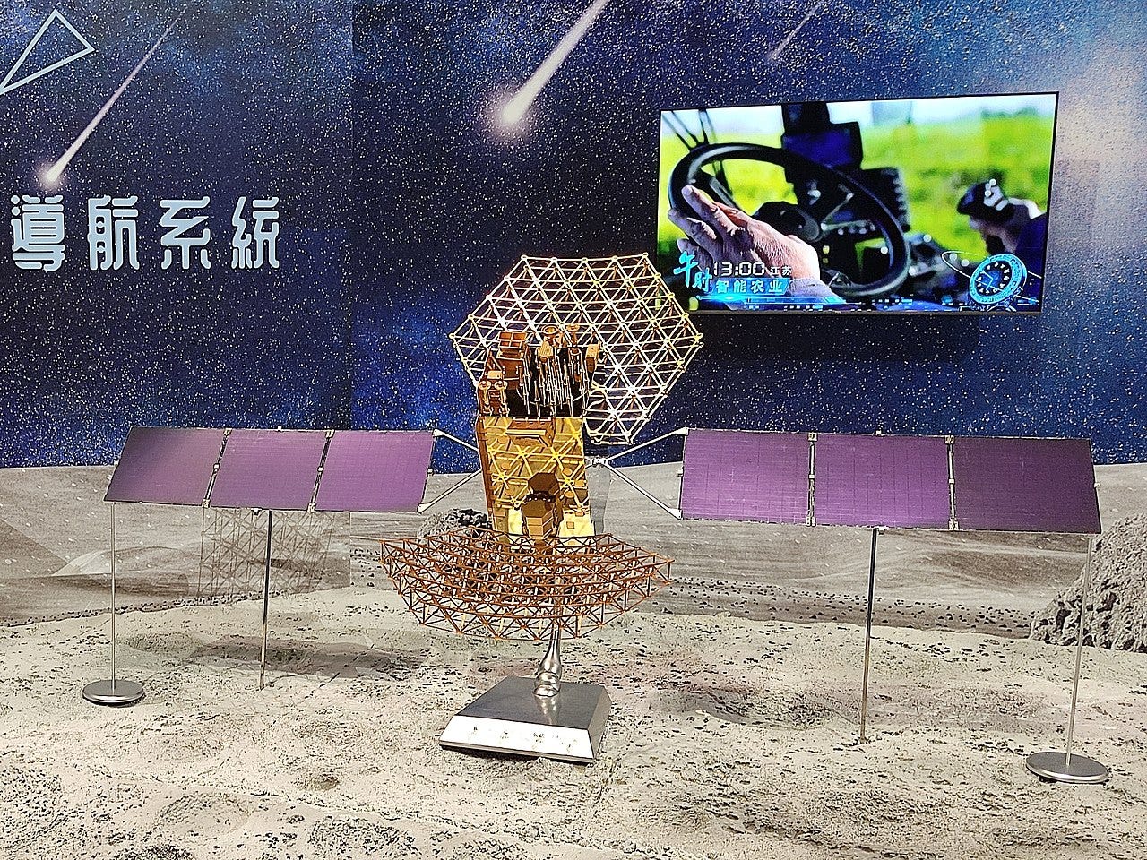
Model of Beidou-3 Navigation Satellite. Credits: BeiDou Navigation Satellite System (BDS): China’s BeiDou Navigation Satellite System (BDS) is a newer system, developed to ensure the country’s strategic independence in satellite navigation. It has undergone several phases of development, with the latest version, BeiDou-3, providing global coverage since 2020. China envisions BeiDou as a key asset in both commercial and military realms.

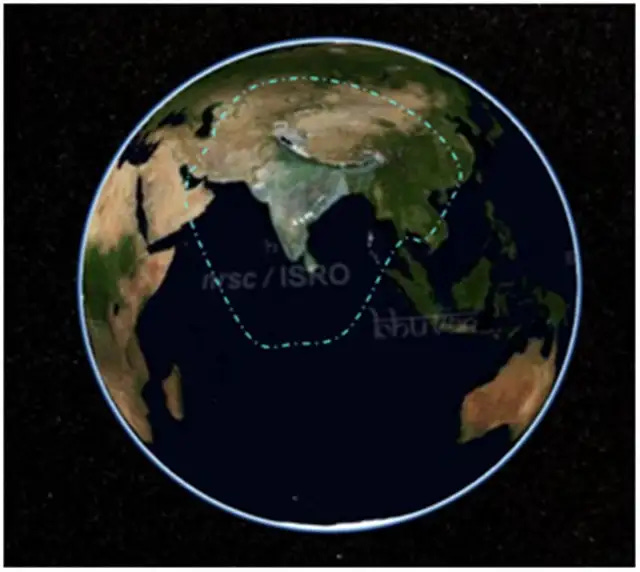
ISRO’s NAVIC Coverage. Credits: ISRO NavIC (Navigation Indian Constellation): India’s Navigation with Indian Constellation (NavIC) is a regional satellite navigation system designed to provide accurate positioning information primarily to the Indian subcontinent and surrounding regions. It’s intended to serve both civilian and military needs, offering an alternative to the global systems like GPS.

Quasi-Zenith Satellite System Orbit. Credits: Tubas, Wikipedia QZSS – Japan: Japan's Quasi-Zenith Satellite System (QZSS) is a regional navigation satellite system that complements GPS. Though it only offers coverage for Japan and nearby regions, it enhances the accuracy and reliability of navigation for civilian and military purposes.
Terrestrial Navigation Systems:
LORAN (Long-Range Navigation): A terrestrial radio navigation system that uses ground-based transmitters to provide accurate positioning.
DECCA: Another terrestrial radio navigation system that uses a chain of transmitters to determine position.
Omega: A very low frequency (VLF) radio navigation system that provides worldwide coverage.
Inertial Navigation Systems (INS):
INS use gyroscopes and accelerometers to measure angular velocity and acceleration, respectively, to determine position, velocity, and orientation without external reference.
Radio Frequency Navigation Systems:
VOR (VHF Omnidirectional Range): A ground-based radio navigation system that provides bearing information to aircraft.
DME (Distance Measuring Equipment): A ground-based radio navigation system that provides distance information to aircraft.


The Need for Backup Satellites
Given the critical role that GNSS systems play in modern society, it is essential to have backup satellites in place to ensure continuous service.
In the event of a satellite failure or jamming, backup satellites can provide redundancy and maintain the integrity of the navigation system. Additionally, backup satellites can be used to enhance coverage in areas where the primary constellation may be weak or unavailable.
Differences and Commonalities Between Systems
Differences
The main differences between these systems lie in their coverage, accuracy, and government policies:
Coverage: GPS, GLONASS, Galileo, and BeiDou offer global coverage, while NavIC and QZSS are regional systems with more limited scope.
Accuracy: Galileo offers superior civilian accuracy compared to GPS, while BeiDou is gaining a reputation for strong reliability in Asia. GPS has the widest usage due to its long history.
Frequency Bands: Different systems use various frequency bands for signal transmission, which affects performance, signal interference, and cross-system compatibility.
Operational Independence: The primary difference is strategic. The U.S., Russia, China, and the EU have developed their systems to ensure independence in navigation, especially for military use.
Commonalities
Despite these differences, many of these systems share some common traits:
Use of Satellite Constellations: All systems rely on constellations of satellites that orbit the Earth, providing real-time positioning data to receivers on the ground.
Civilian and Military Uses: These technologies serve both civilian and military functions, including navigation for vehicles, planes, ships, and military assets.
Interoperability: Increasingly, countries are working toward making these systems interoperable. Devices are often capable of receiving signals from multiple constellations to improve accuracy and reliability.
Dual-Use Nature of Navigation Technology
Satellite navigation technology is often described as "dual-use" because it serves both civilian and military purposes. For civilians, it provides navigation for daily tasks such as driving, flying, or maritime transport. For militaries, it is indispensable for operations like:
Precision-Guided Munitions: GPS or its equivalents are used to guide missiles and drones to their targets with pinpoint accuracy.
Military Communications: Satellite navigation supports encrypted military communications and command-and-control operations.
Surveillance and Reconnaissance: Satellites equipped with navigation tools are also used for reconnaissance, intelligence gathering, and monitoring military activities.
The future of navigation technology is promising, with ongoing advancements in hardware, software, and algorithms.
New technologies, such as quantum navigation and artificial intelligence, are being explored to enhance accuracy, reliability, and security. Additionally, there is a growing emphasis on developing resilient and secure navigation systems to counter emerging threats.
Navigation technology has come a long way since its early days, and it continues to evolve at a rapid pace. As we navigate the challenges and opportunities of the 21st century, it is imperative to invest in research and development to ensure that our navigation systems remain reliable, accurate, and secure.